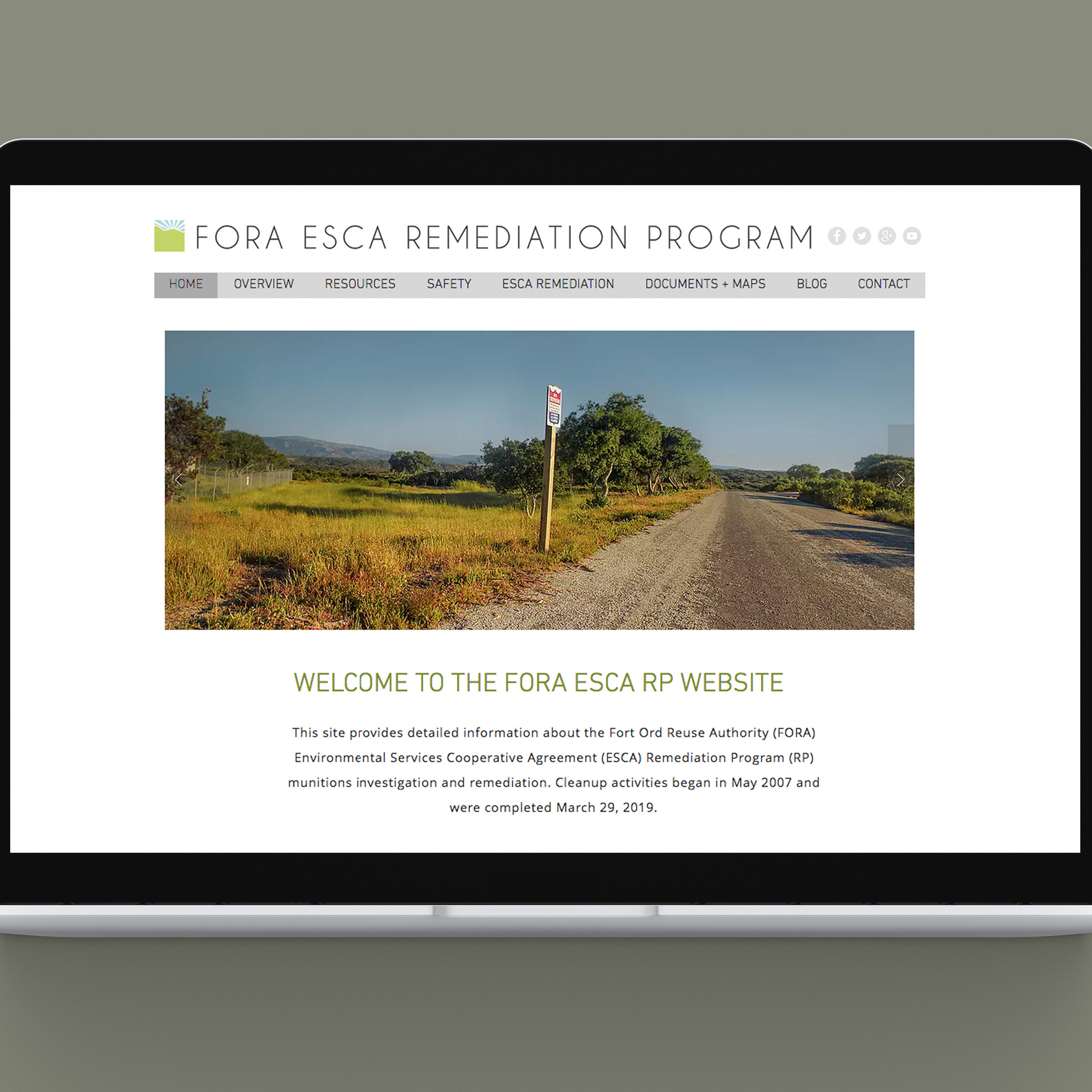
FORA ESCA RP MAPS
For this project, two maps were designed for the Fort Ord Reuse Authority Environmental Services Cooperative Agreement Remediation Program [FORA ESCA RP] to serve different but similar purposes. These were titled the Access Corridor Map and the ESCA Group Map. These maps conveyed the heart of large scale federal environmental cleanup project near Monterey Bay, CA. To learn more about the remediation program, please check out the FORA ESCA branding project page .
Access Corridor Map
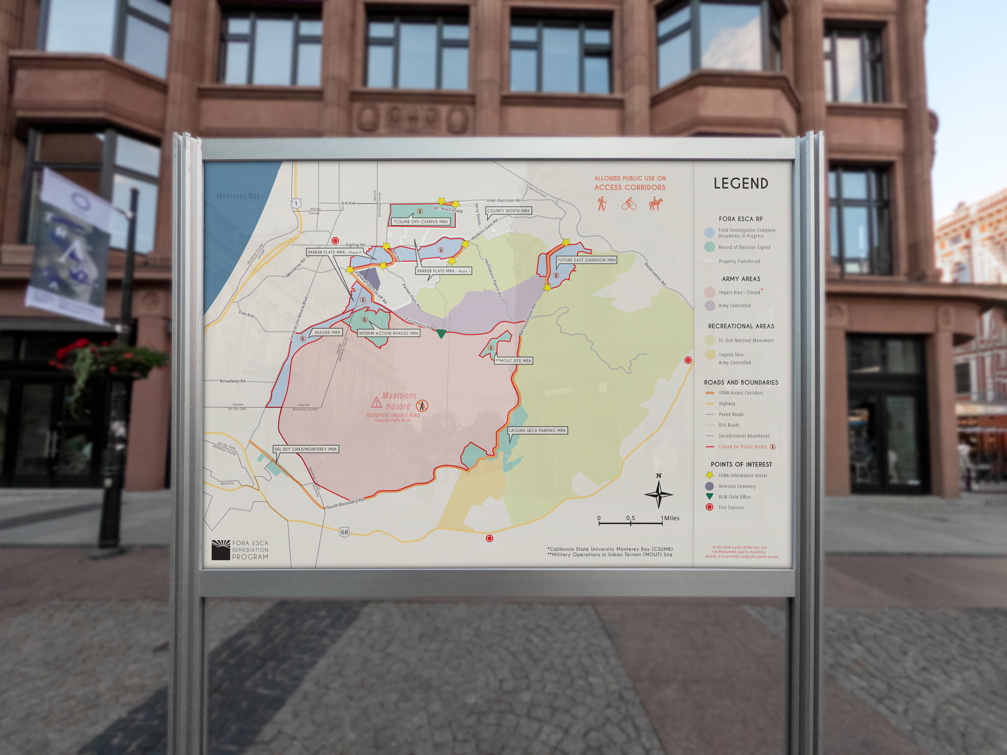
Access Corridor Map
Concept
The purpose of this map was to convey a large quantity of information provided by multiple organizations involved in an environmental cleanup as concisely as possible.
Aspects of this map were determined through the use of satellite imagery, older maps and extensive coordination with representatives from the U.S. Army, Bureau of Land Management, Engineers working with the Fort Ord Reuse Authority, and the local jurisdictions of Seaside, Monterey County, Del Rey Oaks and Marina.
The map depicts newly formed roads and dirt roads designated as "Access Corridors" which offer the public access to recreational areas through areas closed to the public because of munitions hazards. It also shows the parcels being remediated by the FORA ESCA RP and their status of completion at the time the map was developed. When used in conjunction with a trail map offered by the BLM, trail users can navigate the munitions cleanup for access to their favorite trails. Showing where the jurisdictional boundaries are give the public an idea of where the FORA ESCA RP parcels will be transferred after the completion of the cleanup.

ESCA GROUP MAP
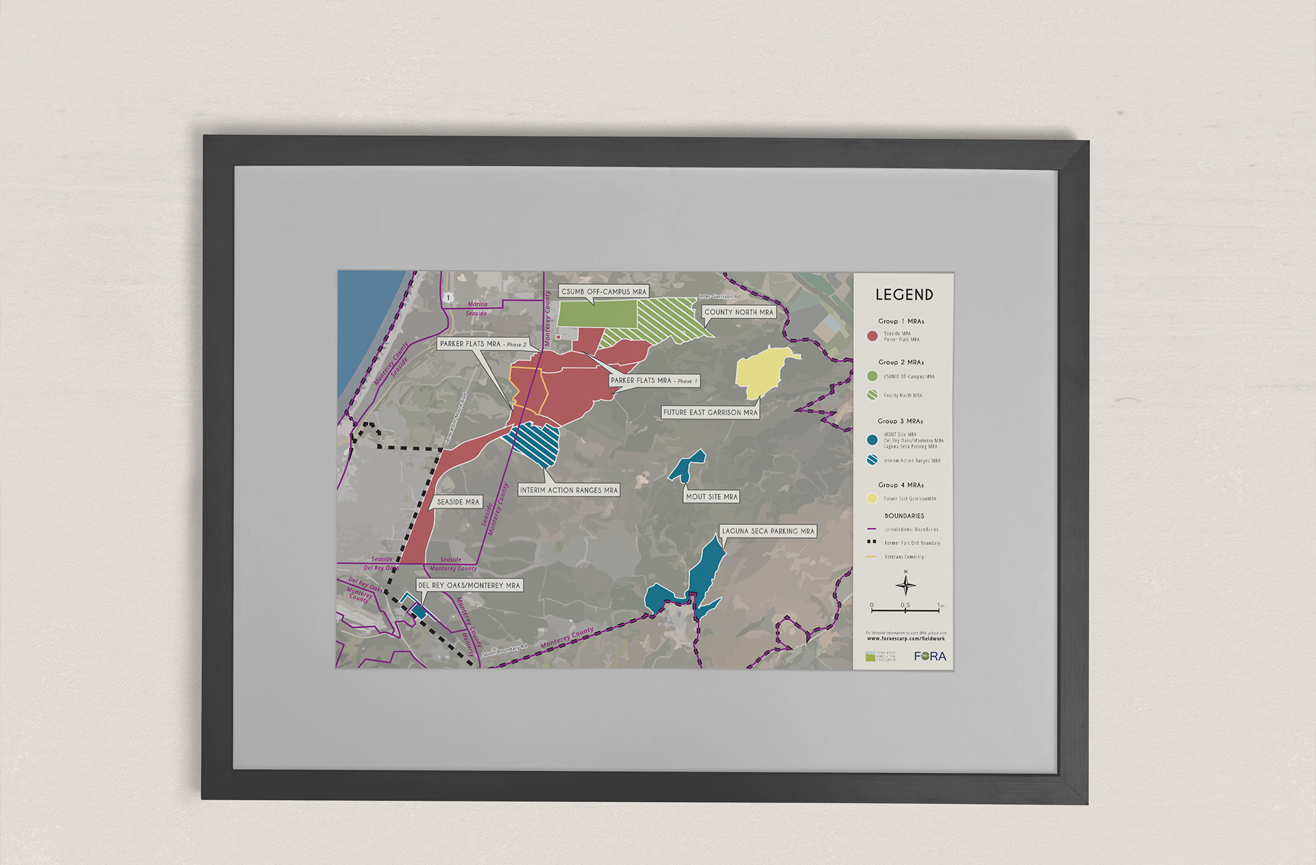
ESCA GROUP MAP
Concept
Unlike the Access Corridor Map, this map was focused solely on the FORA ESCA Remediation Program itself.
It shows only the FORA ESCA RP parcels and the jurisdictions they fall in. Showing where the jurisdictional boundaries are give the public an idea of where the FORA ESCA RP parcels will be transferred after the completion of the cleanup. Crosshatched parcels indicate areas closed to the public due to ground contamination by hazardous munitions. This map was printed to poster size and used during public presentations.

Year: 2015
Project Type: Map, Print Design, Poster Design
Tools: Adobe Creative Suite
Website: www.foraescarp.com